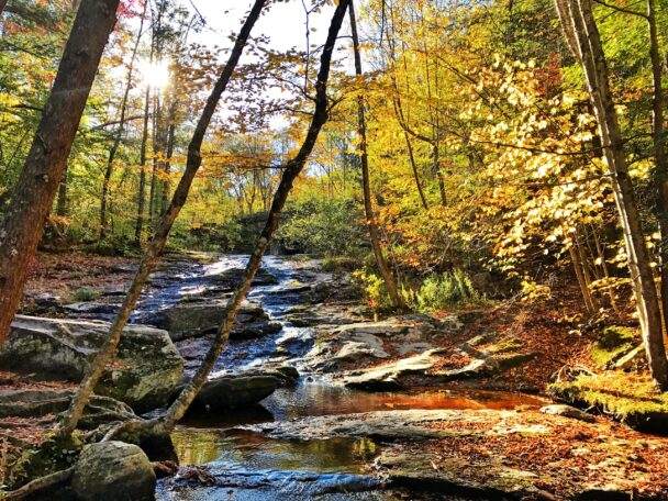
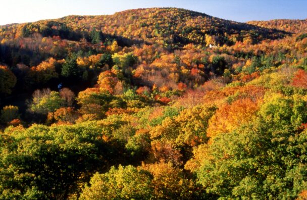
Chapel Brook in fall.
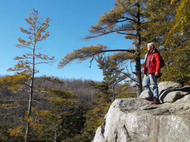
Cool off in picture-perfect pools and falls after reaching the 1,420-foot summit of Pony Mountain.
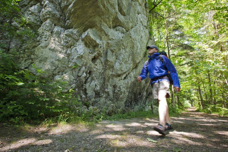
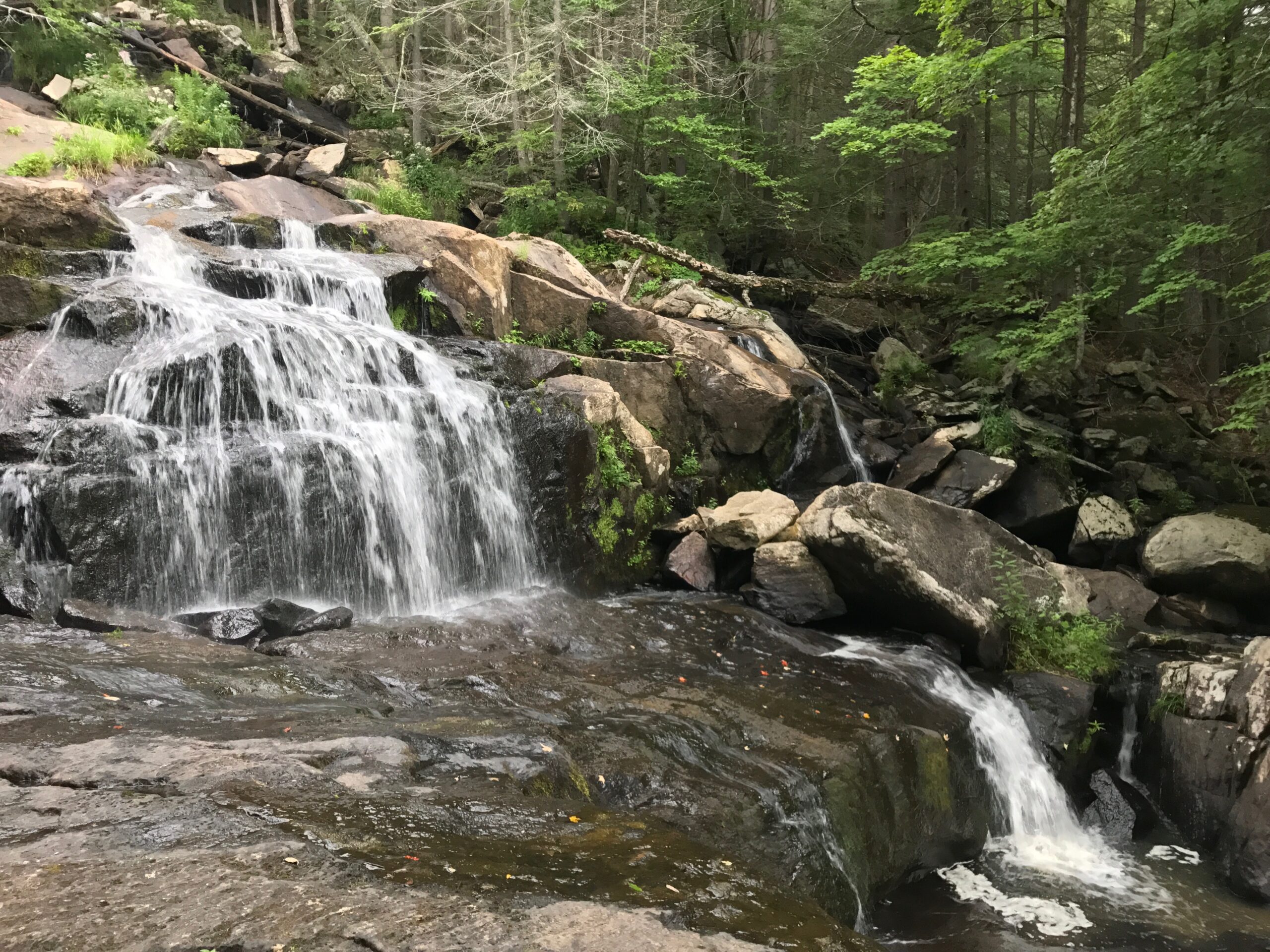
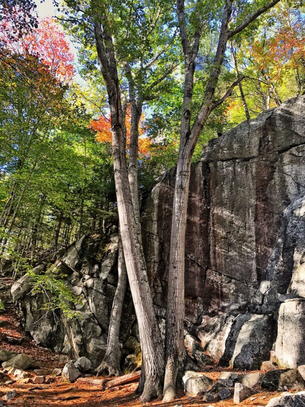
Chapel Brook showcases the rugged beauty of the region, blending steep and deep forests, sensational summit views, and streams that surge and trickle with the seasons. At the heart of reservation lies 1,420-foot Pony Mountain, whose nearly vertical 100-foot rock face enthralls skilled rock climbers. Down below, Chapel Brook—a tributary of the South River— meanders through a dense hardwood forest before cascading over three bedrock ledges. In times of high water, Chapel Falls are in full roar. Come summer, however, the pools offer a cool, welcome dip.
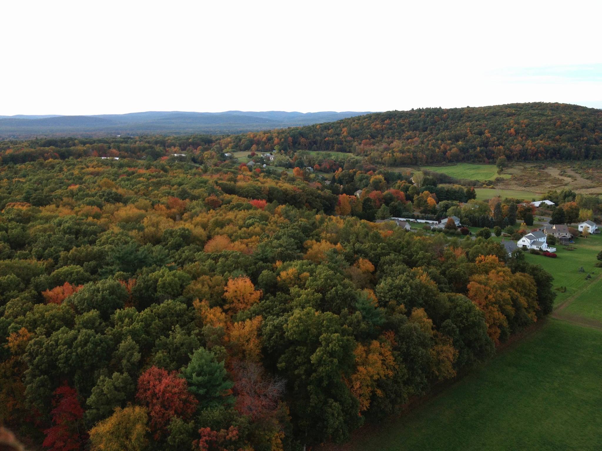
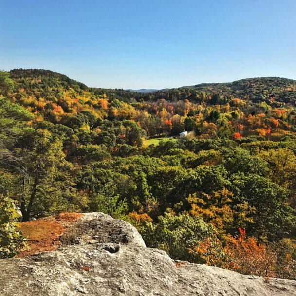
Hike to the top of Pony Mountain via the Summit Trail, which rises to meet the abrupt, vertical, 100-foot rock face of Chapel Ledge and offers a strenuous workout. A less-daunting, half-mile trail leads around the western side of the mountain to its summit. Once there, a grove of trees gives way to granite ledges that drop off precipitously, revealing dramatic views south toward the Berkshire foothills.
You can traverse the lower slopes on the D.A.R. Trail, a footpath built in partnership with the Ashfield Trails Committee. The trail currently takes you above Chapel Brook, past old foundations, along a ridgeline, and through an historic sheep pasture.
FREE to all. Open sunrise to sunset.
While the property is open in the winter, note that we do not plow the parking lot.
Williamsburg Rd.
Ashfield, MA 01330
E-mail: info@thetrustees.org
Get directions on Google Maps.
From Points North: I-91, Exit 36 to Rt. 116 North. After 11.2 mi, continue straight ahead onto Williamsburg Rd. (follow Williamsburg Rt. 9 signs). Follow for 2.2 mi. to entrance on right. Pony Mountain is on right side of street; Chapel Falls is on left. Parking areas (12 cars) on both sides of road.
From Points South: I-91, Exit 25 to Rt. 5 North. After approx. 1 mi. turn left onto Rt. 9 West. Follow approx. 9 mi. Slight right onto North Street. Continue on Ashfield Rd./Ashfield Williamsburg Valley Rd. for 6 mi. Continue onto Williamsburg Rd. to entrance.
The riverbank is an extremely fragile ecosystem. Please stay on marked trails and avoid trampling on vegetation and soils near the water’s edge.
We recommend that you take a photo of the map on your phone so you can refer to it during your visit, or download a trail map before you head out.
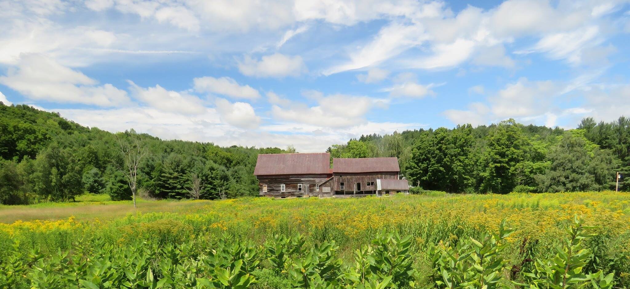
After incorporation in 1765, settlers moved to Ashfield and cleared the forest for pasture. By 1831, Ashfield farmers were grazing more than 8,000 sheep. Around the same time, Chapel Falls became the site of at least two gristmills. A two-room school, which doubled as a chapel, was built above the falls to support the families in this growing community. But, as farmers moved westward, so did the agricultural economy, and farms were abandoned throughout the Highlands. Forests slowly but surely reclaimed their ancient title to the land.
Property Acquisition History
Original acreage a gift, with endowment, of Mrs. Henry T. Curtiss in 1964 in memory of her husband. Additional land purchased in 1981 and 1989 with funds given by Mrs. Curtiss. Additional land given in 1992 by Edward Preissler and Deborah Thomas, and by Michael and Jane McCusker.
What a fantastic place to visit. I like that the falls are close to the road and parking place; don't have to walk far to enjoy the sounds of falling water.
– Shuttergardenimages, Trip Advisor