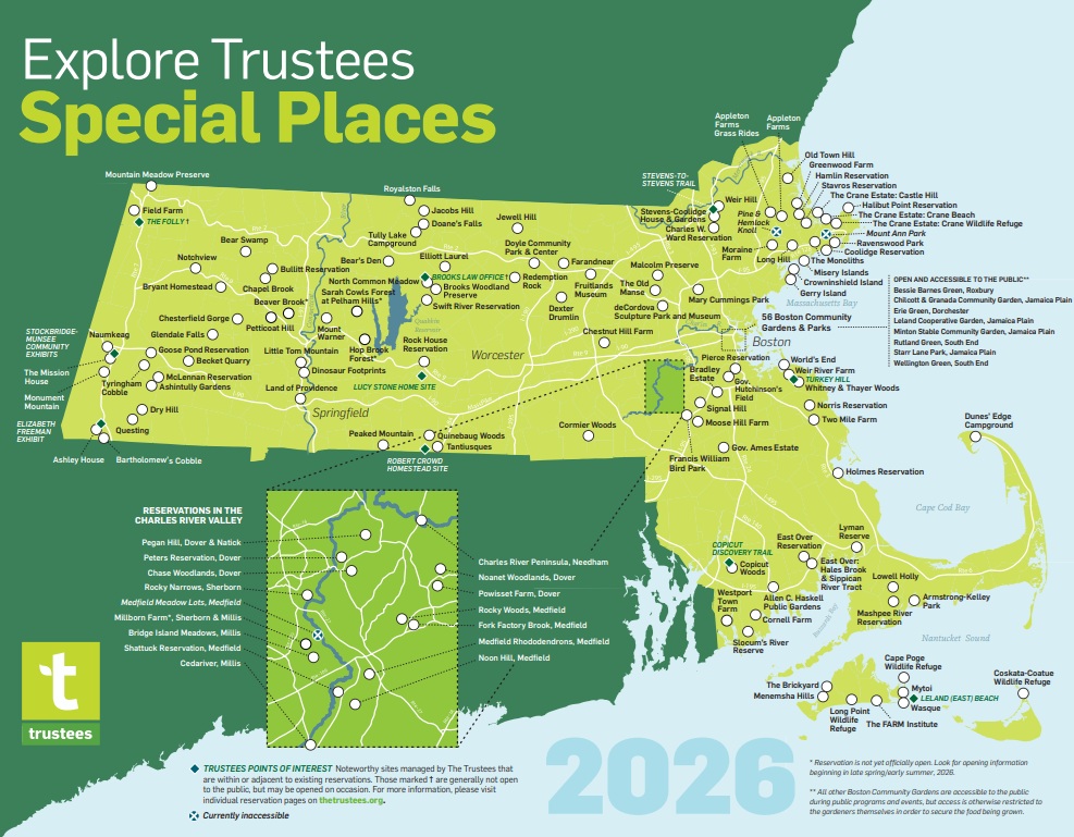
Embark from a trailhead on County Road and explore even more of the scenic East Over landscape.
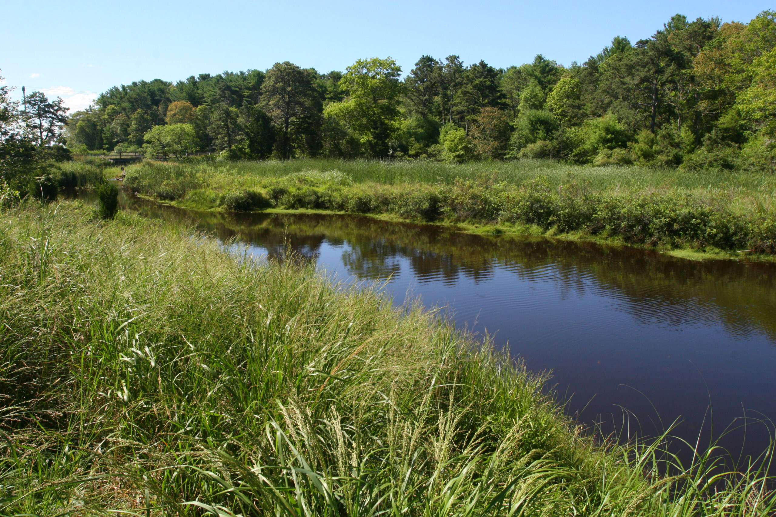
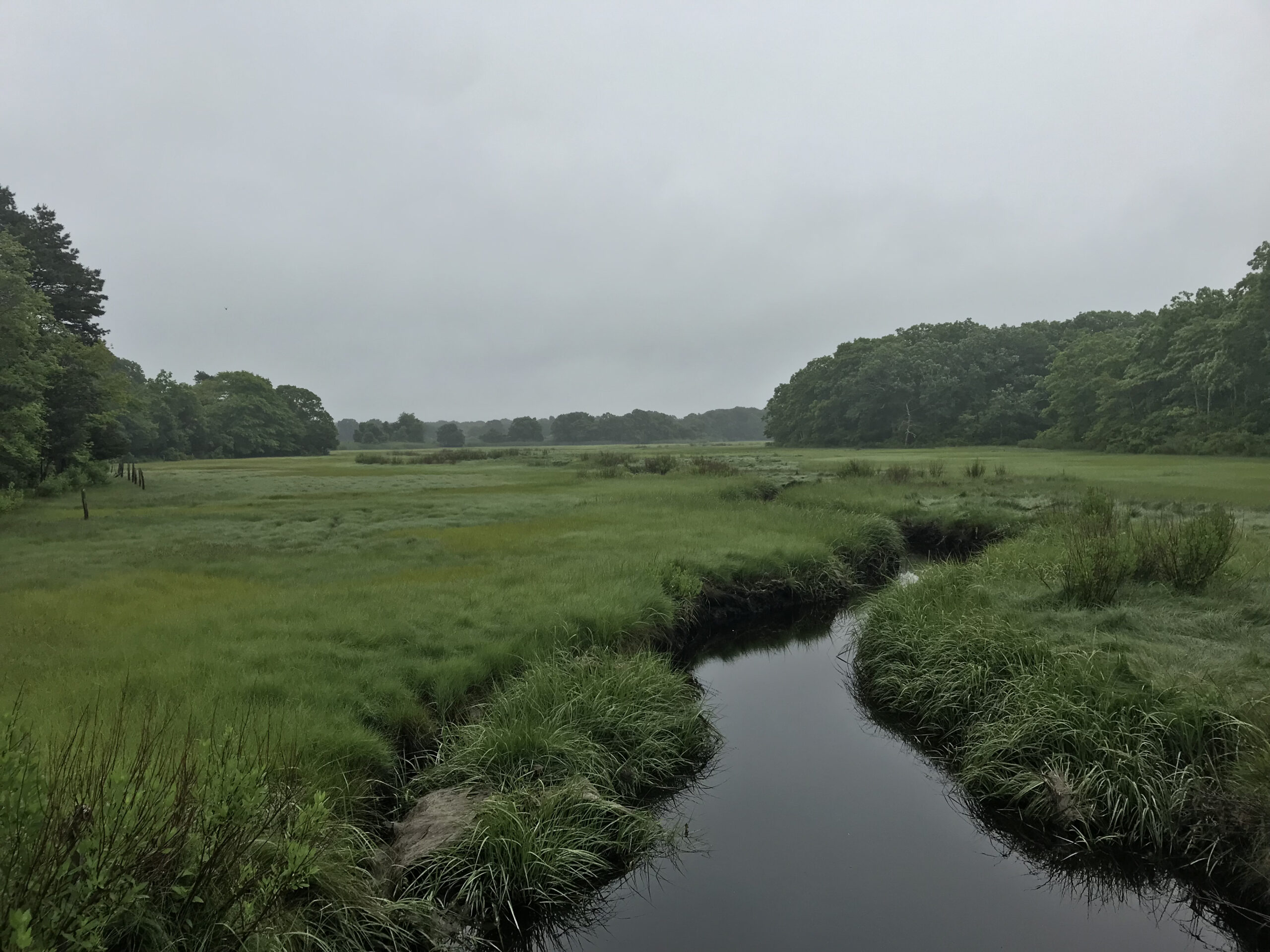
Located on two tracts owned by the Town of Marion and managed by The Trustees, these two and a half miles of forest trail traverse pine and oak uplands and unique wetland habitats.
An easement granted by the neighboring cranberry bog owner, whose active bogs are visible from the trail, connects the Town of Marion’s East Over Reservation to Hathaway Pond and the Town of Rochester, adding about a mile of walking trails to the existing system.
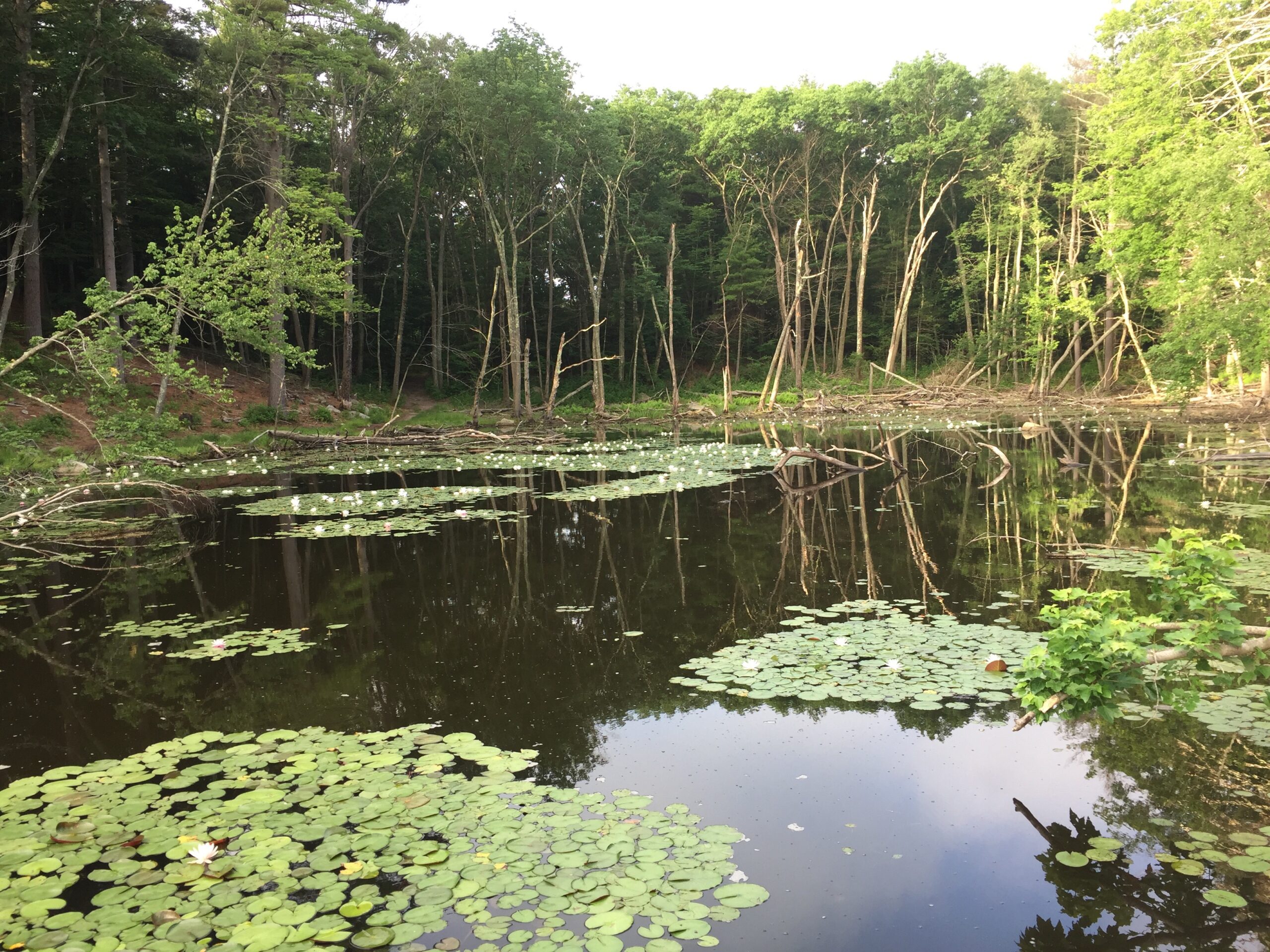
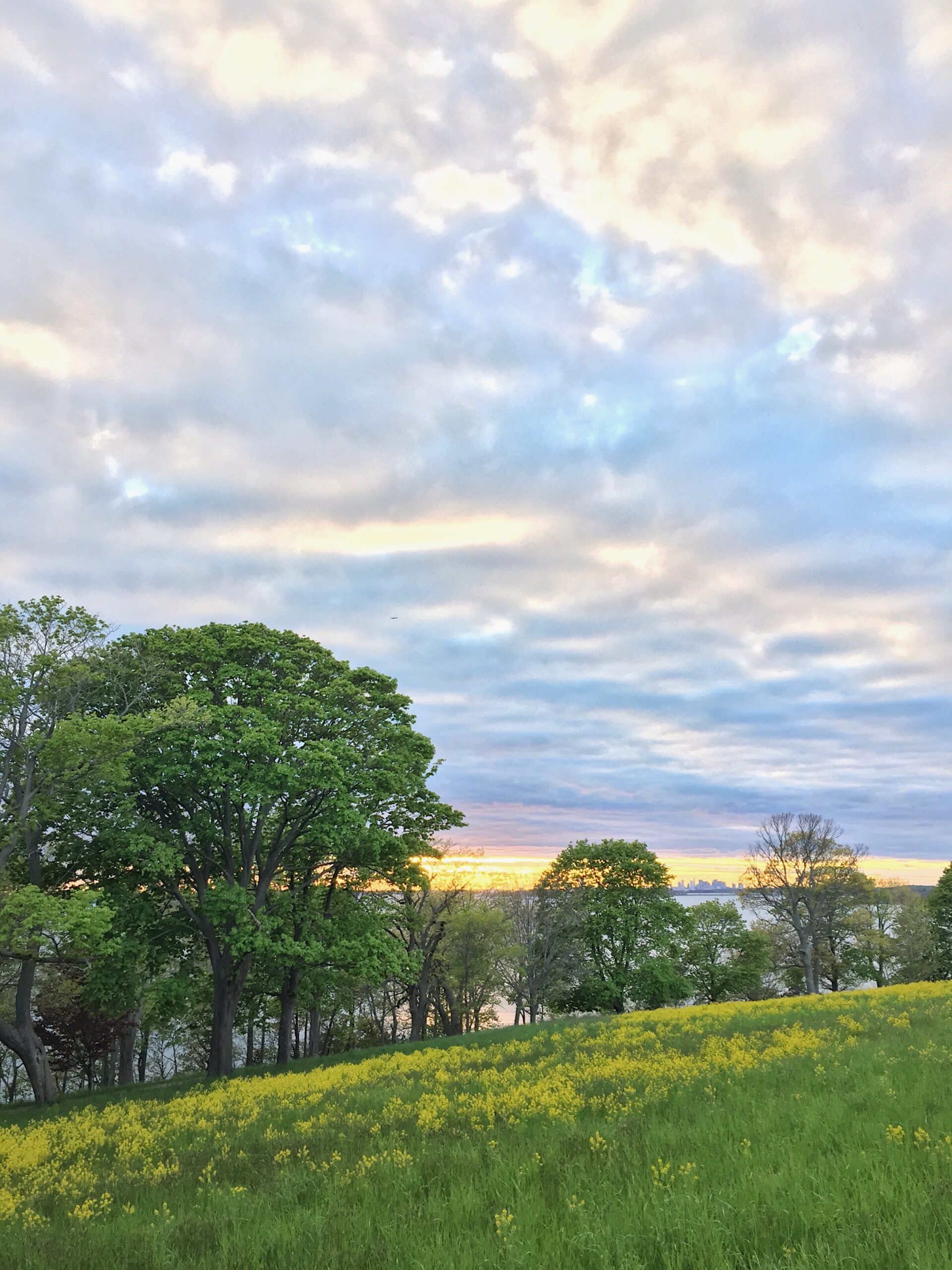
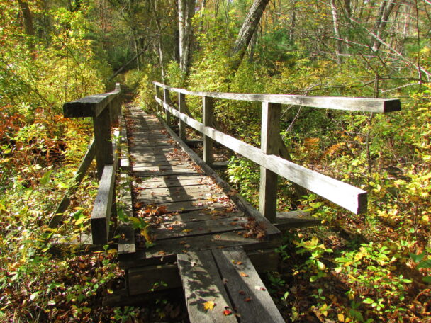
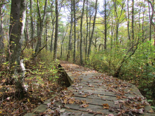
Take in a wealth of sights all around: a dramatic rock outcropping emerges from the forest floor, and an extensive elevated boardwalk gives up-close views of an ecologically sensitive area. On the northern trail loop, traipse across a stone slab bridge crossing over a small stream.
FREE to all
Hours: Sunrise – Sunset
County Road, Marion, MA 02738
Telephone: 508.636.4693
E-mail: southcoast@thetrustees.org
Get directions on Google Maps.
County Road entrance:
From I-195: Take exit 20 and take Rt. 105 North. Go .3 miles and turn right onto County Rd. The parking area is on the left just before 285 County Road.
Clapp Road entrance, from points North:
Take I-495 South to Exit 2, Rt. 58 South. Take a slight right onto Rt. 58; go 0.2 miles to traffic light. Rt. 58 becomes County Rd. Go 2.5 miles to fourway intersection. Turn right onto Mary’s Pond Rd. Go 2.5 miles, then turn right onto Clapp Road. Parking lot is 0.5 mi. on right.
Clapp Road entrance, from points South:
Take I-195 East, Exit 20. Turn left onto Front St./Rt. 105 North. After approx. 1.5 mi. turn right onto Walnut Plain Rd. At first intersection, turn right onto Mary’s Pond Rd. After approx. 0.5 mi., turn left onto Clapp Rd. Parking lot is about 0.5 mi. on right.
Free trail map distributed from bulletin board in the parking area. Please understand that supplies periodically run out.
We recommend that you take a photo of the map on your phone so you can refer to it during your visit, or download a trail map before you head out. You may also want to download a trail map for the adjoining East Over Reservation.
Very pretty area - the trails are well maintained and marked - nice parking area too. Dogs must be leashed. You can walk on the open trails or go into a wooded area as well.
– livem1, Trip Advisor