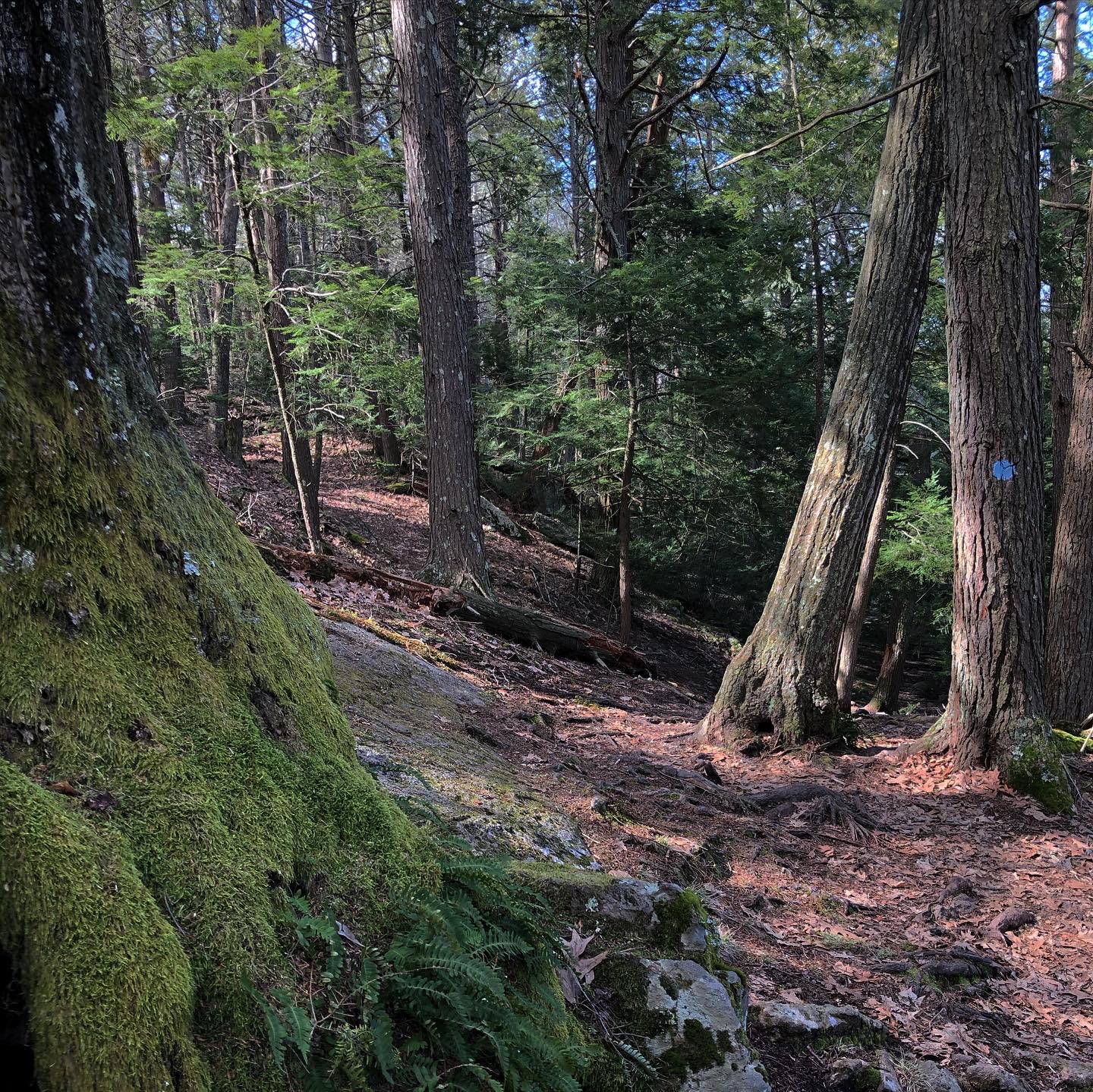
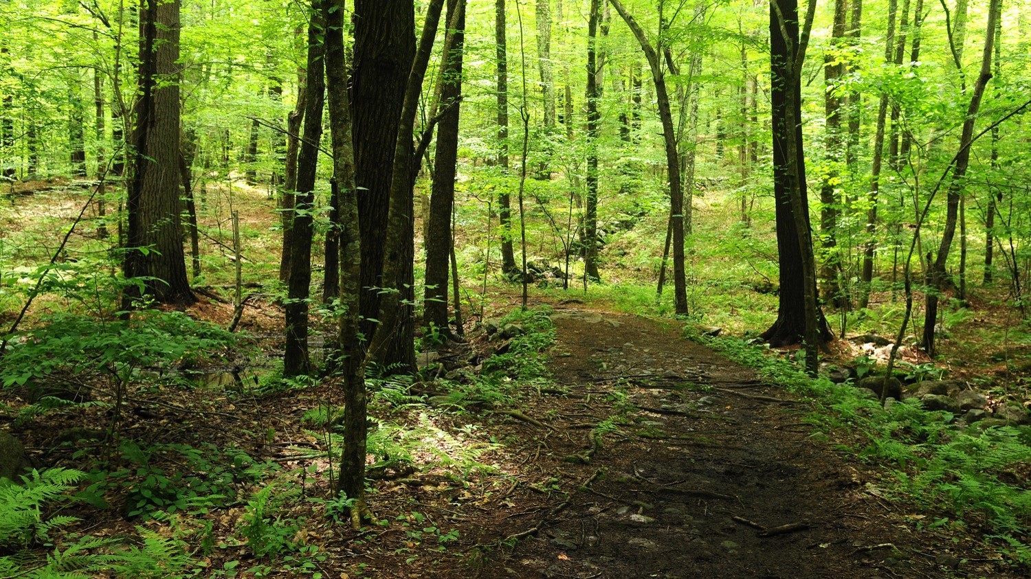
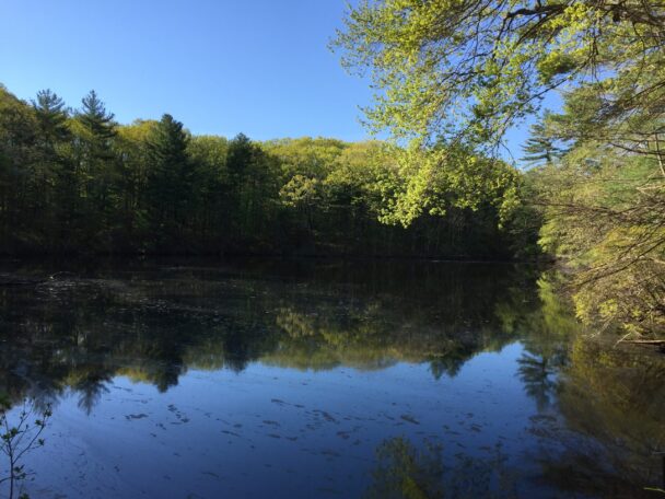
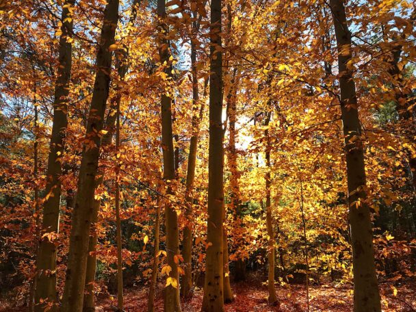
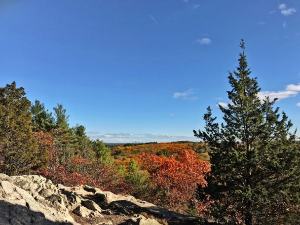
Noanet Woodlands
Find Your Place

About Noanet Woodlands

595 acres

Follow a network of trail across a grand preserve that features woodlands and ponds, a former mill site, and Noanet Peak, which offers views of the Boston skyline.
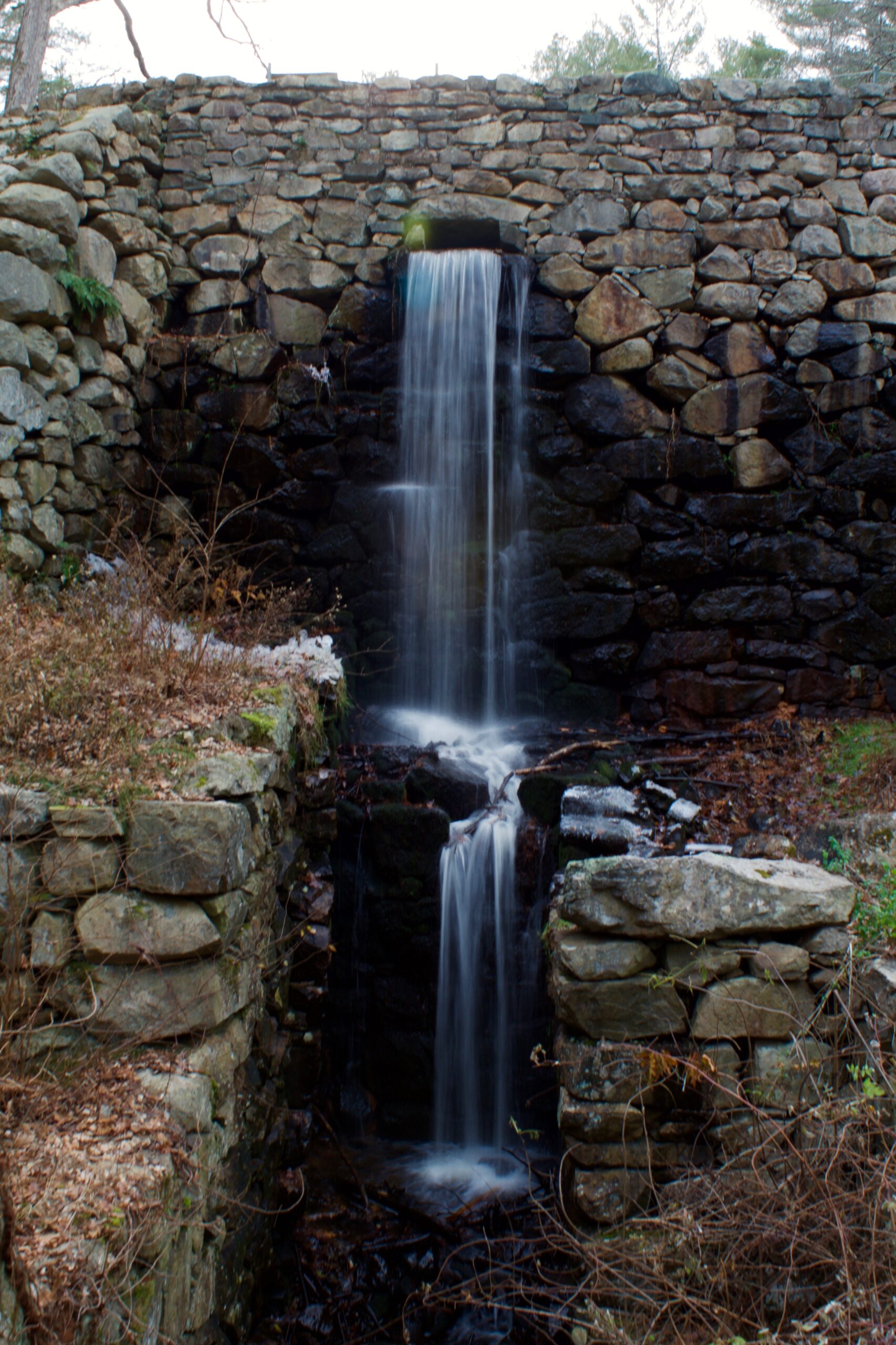
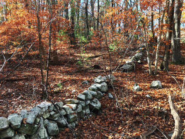
What makes Noanet Woodlands a special place?
We think it’s the more than 17 miles of shady trails and woods roads you’ll find here for walking, cross-country skiing, snowshoeing, and horseback riding. Enjoy leisurely strolls, mountain biking, and birding – you might even hike to the top of Noanet Peak for terrific views of the Boston skyline.

Kids will especially enjoy the popular Caryl Trail, a 0.5-mi. walk to an old mill site. For a more strenuous trek, ascend Noanet Peak for views of Boston. The trails here link to the 1,200-acre Hale Reservation, a privately owned open space preserve that offers more miles of trail for an extended day of hiking, skiing, or riding in the woods.

In the spring, listen to and look for warblers, thrushes, and other songbirds. Scarlet tanagers and northern orioles are common throughout the summer, while hawks migrate overhead during the fall. The four ponds are home to bluegills, painted turtles, and bullfrogs. Wildflowers, including pink lady's slipper, flowering wintergreen, and marsh marigold, abound in the woods and marsh.

Through the centuries, this almost-600-acre landscape has seen many uses – as preserved space, an early industrial site, and Native American hunting ground. In 1923, Amelia Peabody purchased a nearby farm and over the next six decades acquired hundreds of acres. Miss Peabody regularly encouraged the public to enjoy her property, and became a beloved figure in the community.

Trails
17 miles of trails. Moderate hiking, strenuous in places.

When to Visit
Year-round, daily, sunrise to sunset. Allow a minimum of 2 hours.

Regulations & Advisories

  • The Town of Dover prohibits dogs in town-owned Caryl Park parking lot by the tennis courts and The Trustees' ranger station. Dogs not permitted at dam site or around Lower Mill Pond.

  • Parking is prohibited at Caryl Park in April and May, Mon – Fri, 3 – 8pm, when athletic use is often at its peak.

  • There is a precipitous drop over the mill pond dam; closely supervise children.

  • A permit is required to mountain bike at Noanet Woodlands. Download a biking permit form (Word) and biking regulations (Word). Please complete and forward the permit to The Trustees of Reservations, 37 Powisset Street, Dover, MA 02030. You will receive your permit in approximately 2 weeks.

  • Natural gas pipeline not maintained as a trail; please avoid.

Directions

Dedham Street
Dover, MA
Telephone: 508.785.0339
E-mail: charlesrivervalley@ttor.org

Get directions on Google Maps.

From Dover Center, take Dedham St. east 0.6 mi. to Caryl Park entrance and parking (40 cars) on right. Caryl Park provides parking (40 cars) for visitors to Noanet Woodlands.

Admission

When to Visit
Year-round, daily, sunrise to sunset. Allow a minimum of 2 hours.

Admission
FREE to all. On-site donation welcome. Annual mountain bike permit required (FREE).

Property History

“Noanet” was likely the name of a chief of the Natick Indians, a tribal group probably affiliated with the Nipmuc and Wampanoag, who camped on this land, fished the Charles River, and hunted along Noanet Brook. Settlers used the present-day Powisset Farm for agriculture as early as 1720. Powisset’s most notable 18th-century farmer was Samuel Fisher, Jr., who was raising livestock and growing hay and corn by the 1790s. While Powisset Farm was arable, owners initially found little use for the granite hills and ledges and lowland brook and swamp of the adjacent woodlands.

Fisher was the first to look at Noanet Brook and see the potential for industry. He built a sawmill along the banks and did a booming business in the 1820s and 1830s producing building materials for the growing town of Dedham.

In 1815, investors also seeking to harness the power of Noanet Brook falls established the Dover Union Iron Company, and the steep banks of the ravine between Noanet Peak and Strawberry Hill were excavated to make room for a mill. But the company soon fell on hard times and was dissolved by 1840. In 1876, the milldam was breached by a flood and fell into disrepair until 1954, when it was restored. Today, the 24-foot-high dam and opening to the underground tailrace are preserved, but visitors will have to imagine a towering 36-foot overshot wheel that powered the mill.

In the 1830s and 40s, Calvin Richards operated a mill on Noanet Brook on the northeast corner of the property. The site’s shallow slope possibly required an above-ground aqueduct 200 feet long that delivered water from upstream.

In 1923, Miss Amelia Peabody purchased a farm on Dedham Street in Dover. Over the next six decades, she acquired parcels of land stretching south to Powisset Farm, eventually forming an 800-acre estate onto which she invited the public to share her many agricultural and conservation interests. Miss Peabody developed bridle paths throughout the lands she acquired for both herself and the Norfolk Hunt Club. These, and associated fire roads, were meticulously maintained for hiking, horseback riding, and cross-country skiing by the public.

Initially, Miss Peabody used part of her property to stable thoroughbred horses for show, sale, hunting, and riding. By the end of World War II, she had acquired a herd of Hereford cattle and a number of Yorkshire pigs, the best specimens of which she entered in livestock shows throughout the region. “Field days” for pig farmers and cattle breeders were frequently held at her farm. She was also interested in food crops, and planted and harvested potatoes and sweet corn. Her interest in conservation led Miss Peabody to plant native species of wildflowers, trees, and shrubs on parts of her estate. To ensure the long-term conservation of her the land, she bequeathed property to both the New England Wildflower Society and The Trustees of Reservations when she died in 1984.

Property Acquisition History
Original acreage a bequest, with endowment, of Amelia Peabody in 1984. Added to previous gifts of Mrs. Henry B. Cabot in 1975 and Henry B. Cabot, Jr. in 1979. Additional land given by Brookfield Estates in 1996.


Programs

Click here to learn more about our Summer in the Valley Photo contest.

Volunteer Opportunities

There are no volunteer positions at this reservation at this time; please check again later or click here to find other opportunities near you.

Work Parties

There are no work parties at this reservation at this time; please check again later or click here to find other work parties near you.

Maps and Resources

Printed trail maps are distributed free from the ranger station and bulletin board in the Caryl Park parking area. Please understand that supplies periodically run out. We recommend that you download a trail map before you visit.
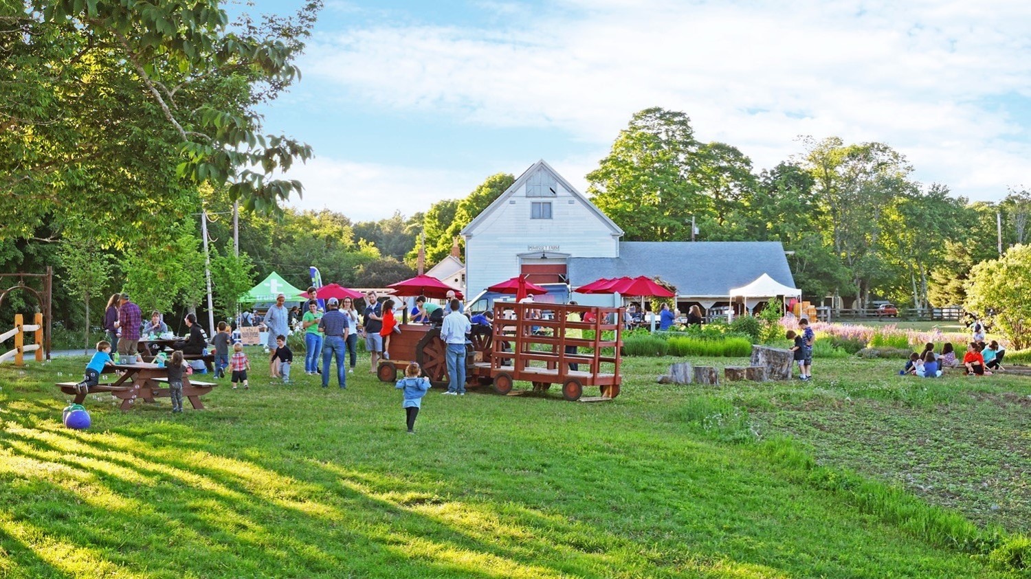
Additional Resources:

Planning Your Visit

Before You Go
We encourage you to visit as many Trustees properties as you can.

Wherever your travels take you, please observe all posted regulations, follow special instructions from property staff, and keep in mind the Stewardship Code:

  • Protect wildlife and plants.
  • Guard against all risk of fire.
  • Help keep air and water clean.
  • Carry out what you carry in.
  • Use marked footpaths and bridle paths.
  • Leave livestock, crops, and machinery alone.
  • Respect the privacy of neighboring land.
  • Enjoy and share the landscape with others.

Click on links below for further visitor information:

Before Setting Out

Enjoying Trustees Reservations

Safety

About Hunting on Trustees of Reservations Land

Tell Us What You Think

We’d love to hear about your visit. Click here to take our visitor survey. If you have a question for us about this reservation, you can use this form to send it to us, too.

Share your experiences with other visitors! Simply fill out the form below and we’ll post your comment here on this page.

Submitted by Cara on: April 3, 2010
Saw a baby beaver on wood over the spillway at the ponds near Caryl Park. Thought it was a musgrat but saw flat tail when it went of the log. The power of the water coming out frightened me but not him. I know this dries out each year. should he be removed.


Submitted by Bill on: October 26, 2009
Made my first (but not last) visit to Noanet Woodlands yesterday. Great views, especially Boston skyline, trails very well maintained, excellent map available at parking lot. This is a beautiful place, great walking and picture-taking experience.


Nickname
Comment
Enter this word:

Announcements & Alerts

SHOOT, ENTER, WIN! The 4th annual Summer in the Valley photo contest.  Learn More >> 

Throughout 2009, the trail network will be undergoing changes, which may require trails to be closed or re-routed. Changes will be noted with signs on-site. 

Upcoming Things To Do
No events for this reservation at this time.
Other Trustees Properties You Might Like:

Powisset Farm
Dover, MA

Rocky Narrows
Sherborn, MA

Noon Hill
Medfield, MA