Peter Marotta
Descend a short stream-side trail and experience a raucous series of plunging falls.
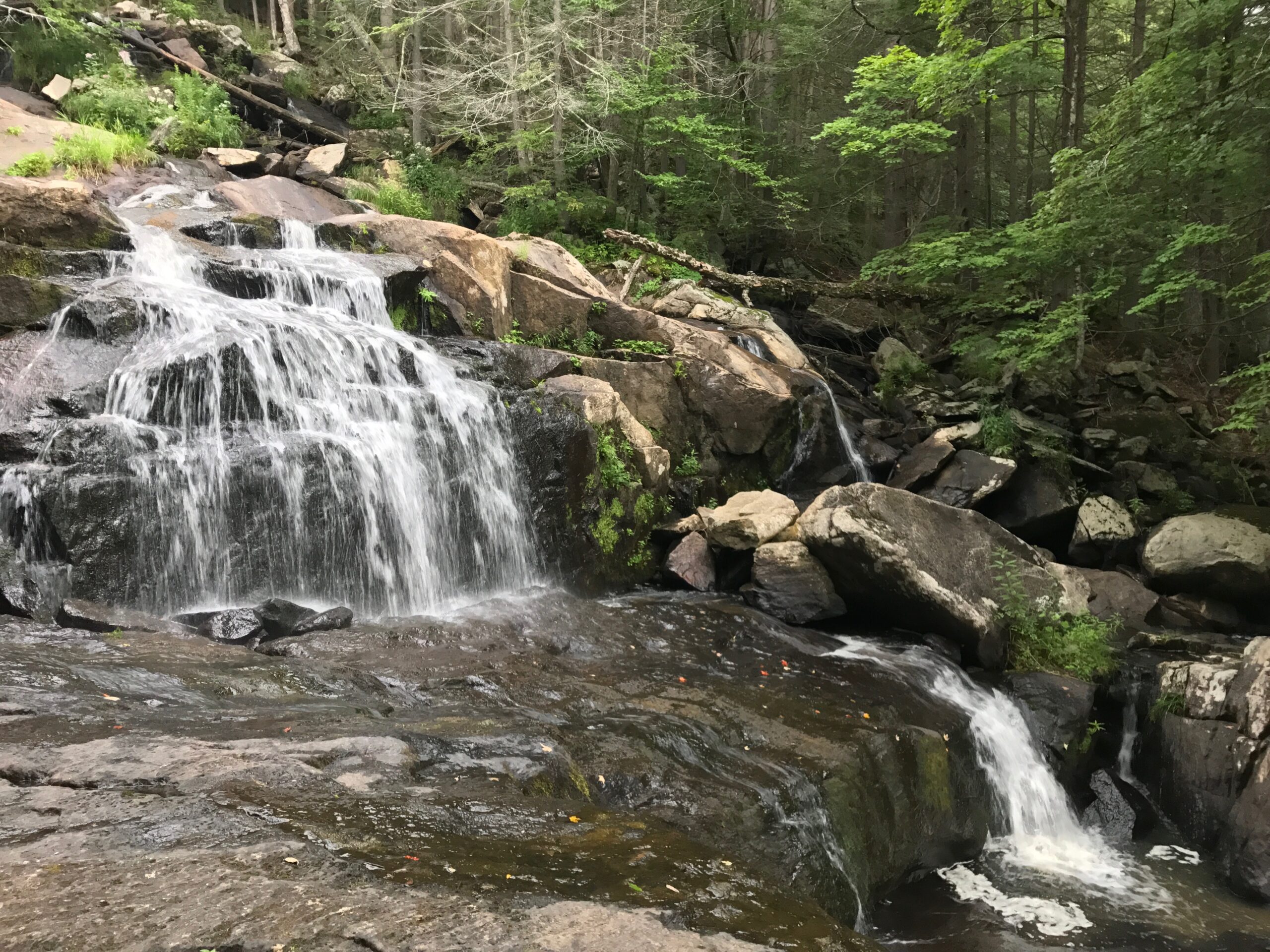
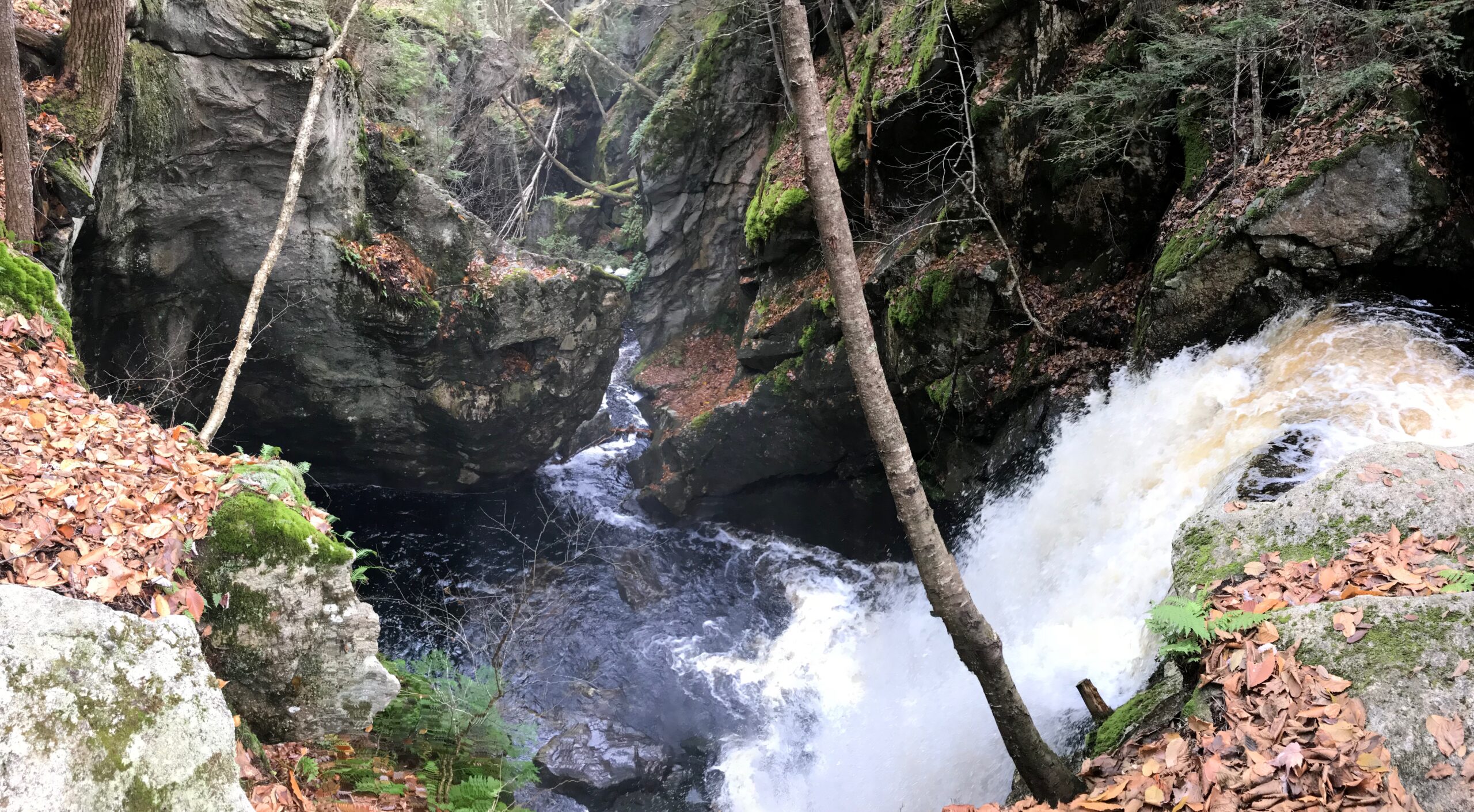
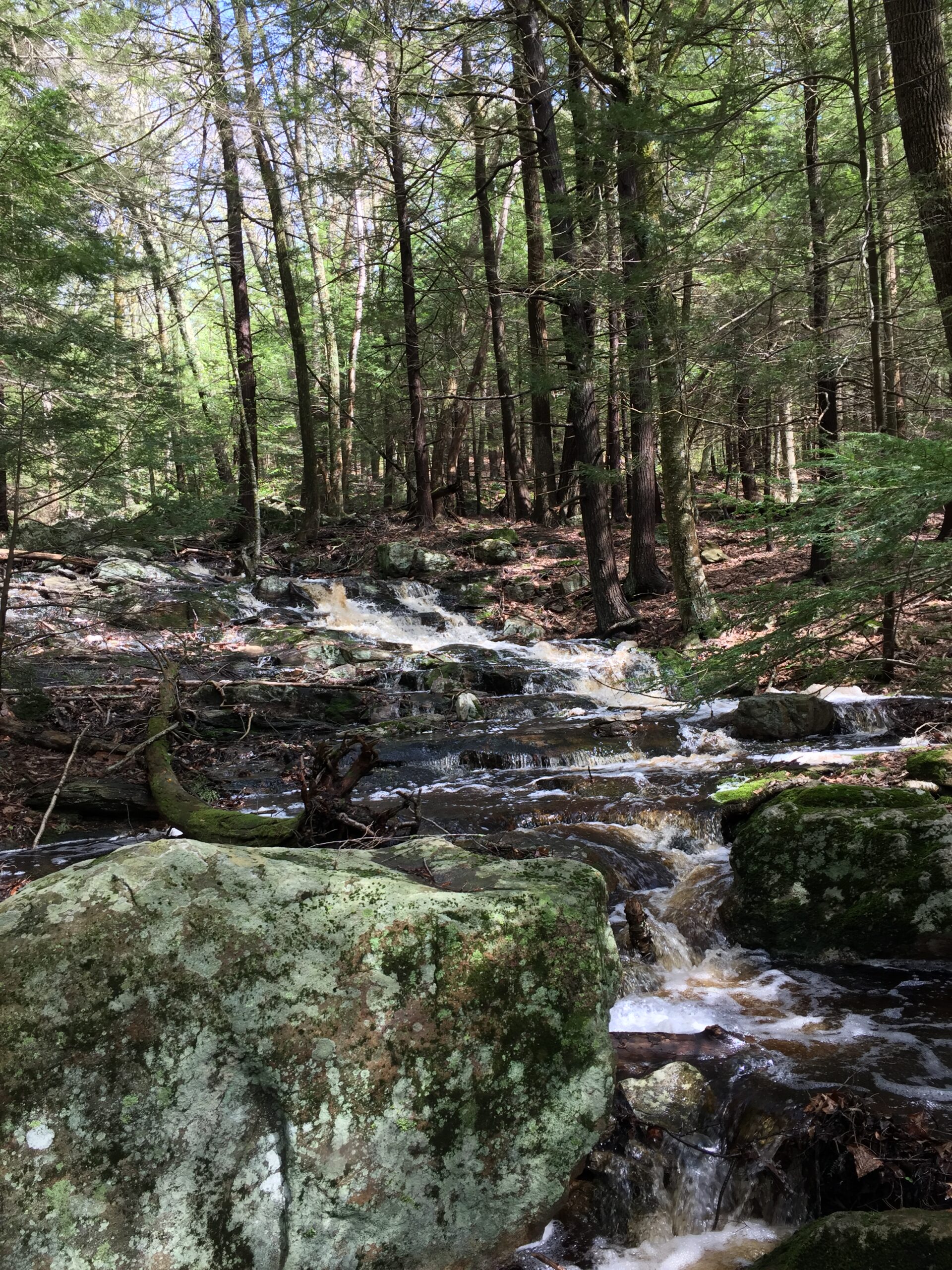
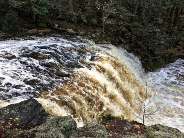
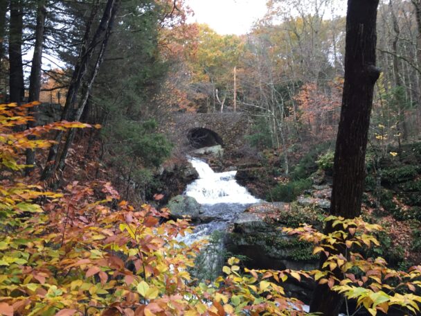
Doane’s Falls on Lawrence Brook grabs your attention by tumbling from under a picturesque stone bridge in a frothy frenzy to Tully Lake. A half-mile trail leads down the west side of the stream, offering great vantage points of the drops and swirls as water continually rushes over and along mid-stream boulders, flat granite slabs, and small islands.
The falls are named for Amos Doane who owned land in Royalston in the early 19th century. He built a mill—50 feet long and more than four stories tall—above the falls to manufacture doors, sashes, and blinds. Though Doane’s venture eventually failed, a series of previous mills had successfully operated on the falls. The Trustees manages Tully Lake Campground just west of Doane’s Falls
A half-mile trail leads down the west side of the stream, offering great vantage points as Lawrence Brook drops and swirls, its water continually rushing over and along mid-stream boulders, flat granite slabs, and small islands.
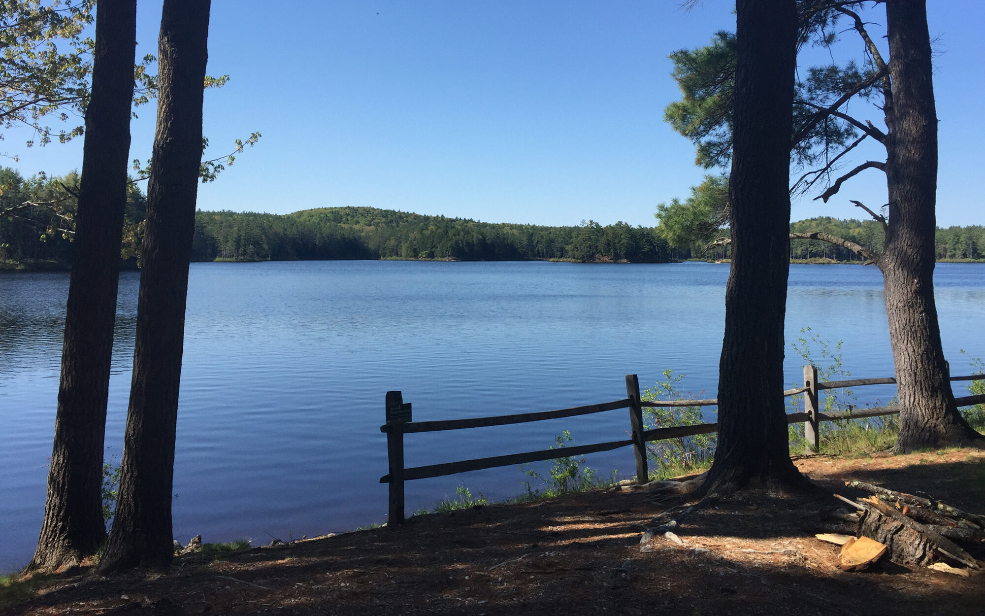
Just upstream awaits Coddings Meadow, a quiet clearing amid surrounding woodlands with fine views of the brook in its quiet-water state. Be sure to bring your paddle: the meadow serves as an easy launch site for canoeists and kayakers looking to explore the upper stretches of the intimate river, encountering occasional beaver dam as the water winds through a red maple swamp.
The Trustees manages the Tully Lake Campground on Doane Hill Road, just west of Doane’s Falls.
WHEN TO VISIT
Daily, sunrise to sunset. Allow a minimum of one hour.
ADMISSION
FREE to all.
Please note that access to the water is prohibited for safety reasons.
Athol Road
Royalston, MA 01368
Tully Lake Campground: 978.249.4957 (seasonal)
Email: info@thetrustees.org
Get directions on Google Maps.
From Rt. 2, Exit 77, follow Rt. 2A West into Athol. At intersection with Rt. 32, cross Miller’s River Bridge and bear right onto Chestnut Hill Rd. (becomes Athol Rd.) north toward Royalston. Proceed 4 mi. to entrance and parking (3 cars) on left. To Coddings Meadow at Lawrence Brook, walk 0.5 mi. down gated woods road off Athol Rd. on right just before stone bridge.
Trails
A half-mile trail leads down one side of the stream. Moderate walking, strenuous in places. A three-quarter-mile woods road leads to the 14-acre Coddings Meadow along side of Lawrence Brook. Doane’s Falls is a link in the Tully Trail.
Accessible Features
Accessible trail is approximately .15 mile trail starting at the lower parking lot on Doane Hill Road to the lower falls section.
You can download a Doane’s Falls trail map before you head out. You can also download a map of the 22-mile Tully Trail.
Swimming, Diving, and Wading Ban
Swimming, diving, and wading at Doane’s Falls have led to fatalities and serious injuries over the years. While beautiful, the depth of the pools at Doane’s Falls is not safe for jumping or swimming. We do not allow swimming at this site.
To balance the fullest and safest use of our properties, we generally rely on a range of measures, from the display of informational and cautionary signs to the placement of physical barriers to prevent access to certain areas. However, for your protection, The Trustees now prohibits these inherently risky activities at this property.
Hunting Advisory
Hunting is permitted on the Coddings Meadow parcel associated with this property subject to all state and town laws. It is recommended to wear brightly colored clothing like an orange vest or hat during the hunting season. Hunting is not allowed on Sundays. Learn more about hunting on Trustees properties, and read safety tips for non-hunters.
Other Regulations
Relax by a pristine shoreline and spend the night under the stars in this beautiful corner of the world.
Beautiful place for a day hike. Water falls will take your breath away.
– Nanciepg, Trip Advisor